Stewart Island, New Zealand's third island
24/Nov 201112-11-2011 until 17-11-2011
As there isn’t much to say about the first two days I spent in Invercargill (the first day I enjoyed the sun in the park, and the second day I did laundry and other stuff while it was raining), this post is about my time on Stewart Island.
Stewart Island, or Rakiura, is seen by many as New Zealand’s third island as it’s the biggest island outside of the North Island and South Island. More info on Wikipedia. Still, with a population of about 400 people and 85% of the island being a national preserve, there isn’t much in the way of infrastructure. But there is a lot of nature, and that was my reason for going there.
It’s also one of the most southern points in the world, and thereby pretty close to Antarctica, and one of the places with the highest possibility of seeing a kiwi.
Of course, I didn’t expect Vodafone not to work on the island at all, or I would have given a bit more of a heads-up that I wouldn’t be reachable for a while. And with internet available at the friendly rate of only 2 dollars per 15 minutes, I didn’t feel like using a Windows pc to give any updates either. So, what was there to do on Stewart Island?
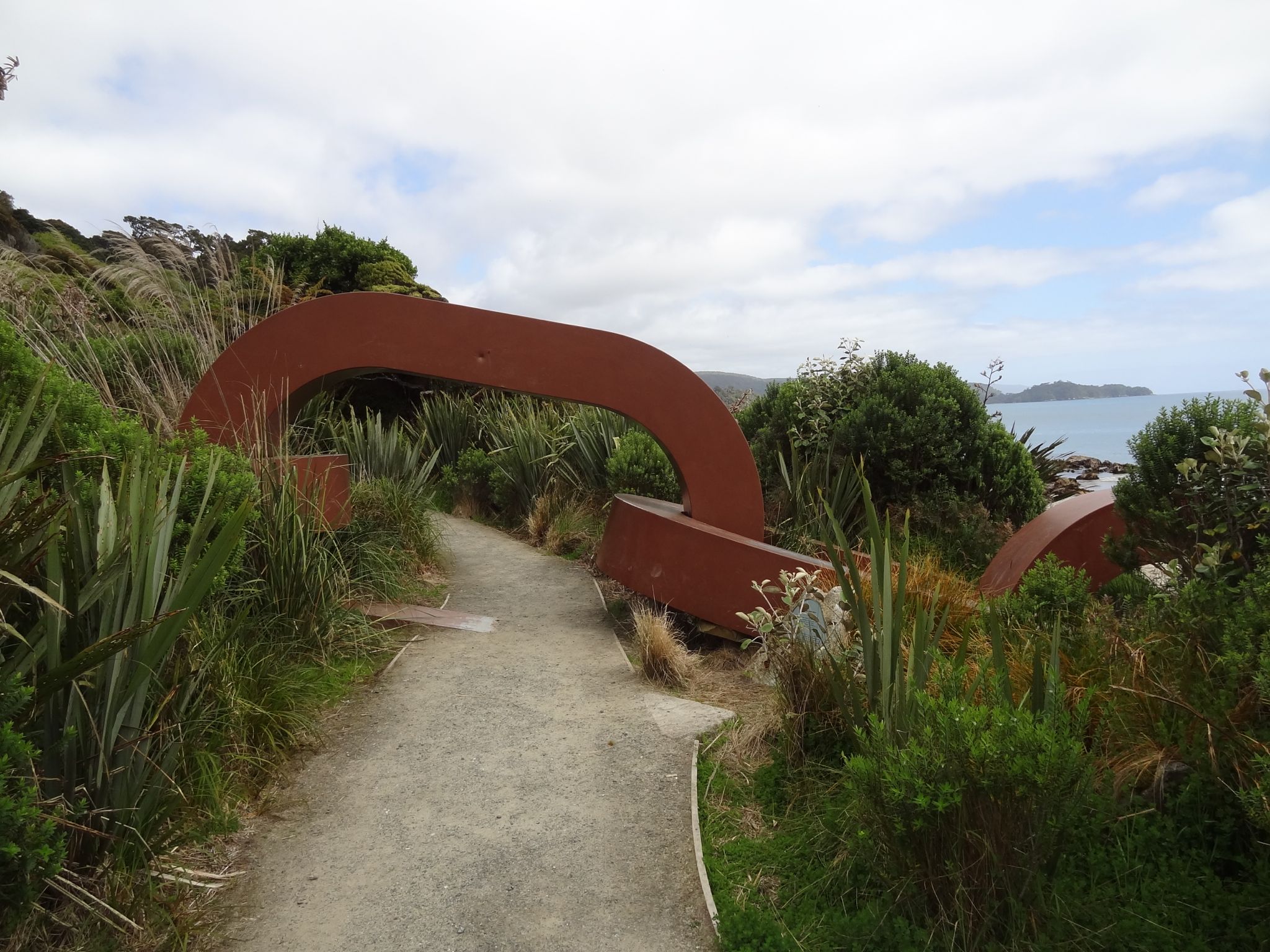
Oban and surroundings
Ryan’s Creek
Oban is the big town on the island. It’s where you arrive with the ferry and it has at least 4 streets. But to be honest, there isn’t much to do except do some walking around. So, when I arrived I checked with the Department of Conservation, to see what walks were possible. As one of them went past something called Ryan’s creek, that was my first target. After all, Ryan never told me he had a creek named after him so I had to see this for myself. This walk was pretty nice, and once I’d finished it I didn’t return to the town, but just started on the next one.
Friendly people everywhere
I pretty much continued this way, exploring what there was to see around Oban itself, until I could start on the Rakiura track itself. The tracks differed from half an hour, to half a day (at least according to the planning, but I suspect that was based on people who walked around with two broken legs). Basically it was a lot of fun to just walk around, and everybody was really friendly.
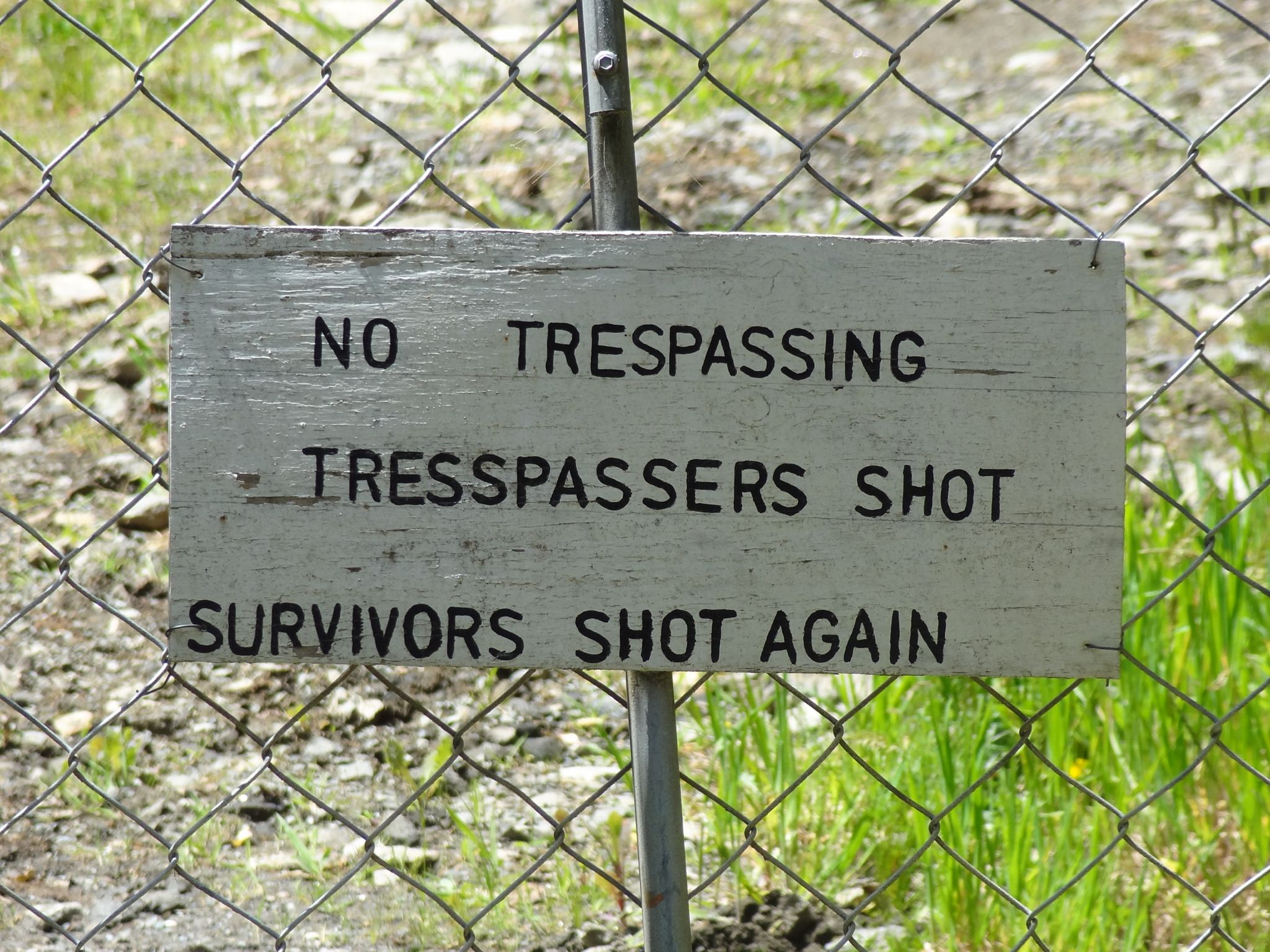
Of course, it is a bit of a tourist area, so they took some precautions. But hey, ignore a warning at your own risk, right?
Rakiura track
The Rakiura track is one of New Zealand’s so called Great Tracks. This was a three day walk around part of the island, and I felt like doing it to see how things would go. Of course, I didn’t actually expect to like the walking so much that I’ve decided I want to do all 9 Great Tracks (one of which is actually by kayak). However, I’m getting ahead of myself, so let’s start at the beginning.
The track is a 3 day hike through parts of the island you can only reach following this track. There’s actually a larger, 12-day track around the entire island as well, but that was too much for me.
Chain to the South Island
The first day of the track was around the west coast, to a hut at Port William. The route started by going over the streets, but after about 4 kilometers I could turn onto the walking track, where I passed under the symbolical chain that connects Stewart Island to the “mainland” of the South Island. Walking past this I encountered many beautiful sights of the sea and was able to hear birds all around me the whole time. Often hearing was as often as I could come though, let alone being quick enough to get my camera. Still, this was pretty amazing. It was also a nice and easy walk with perfect weather.
After about 4 hours I’d reached the hut. This was time spent relaxing on some of the beaches (read trying to outrun the sandflies) and talking to an American who was walking part of the track. I’d met him earlier in Dunedin, so it was fun to meet him again.
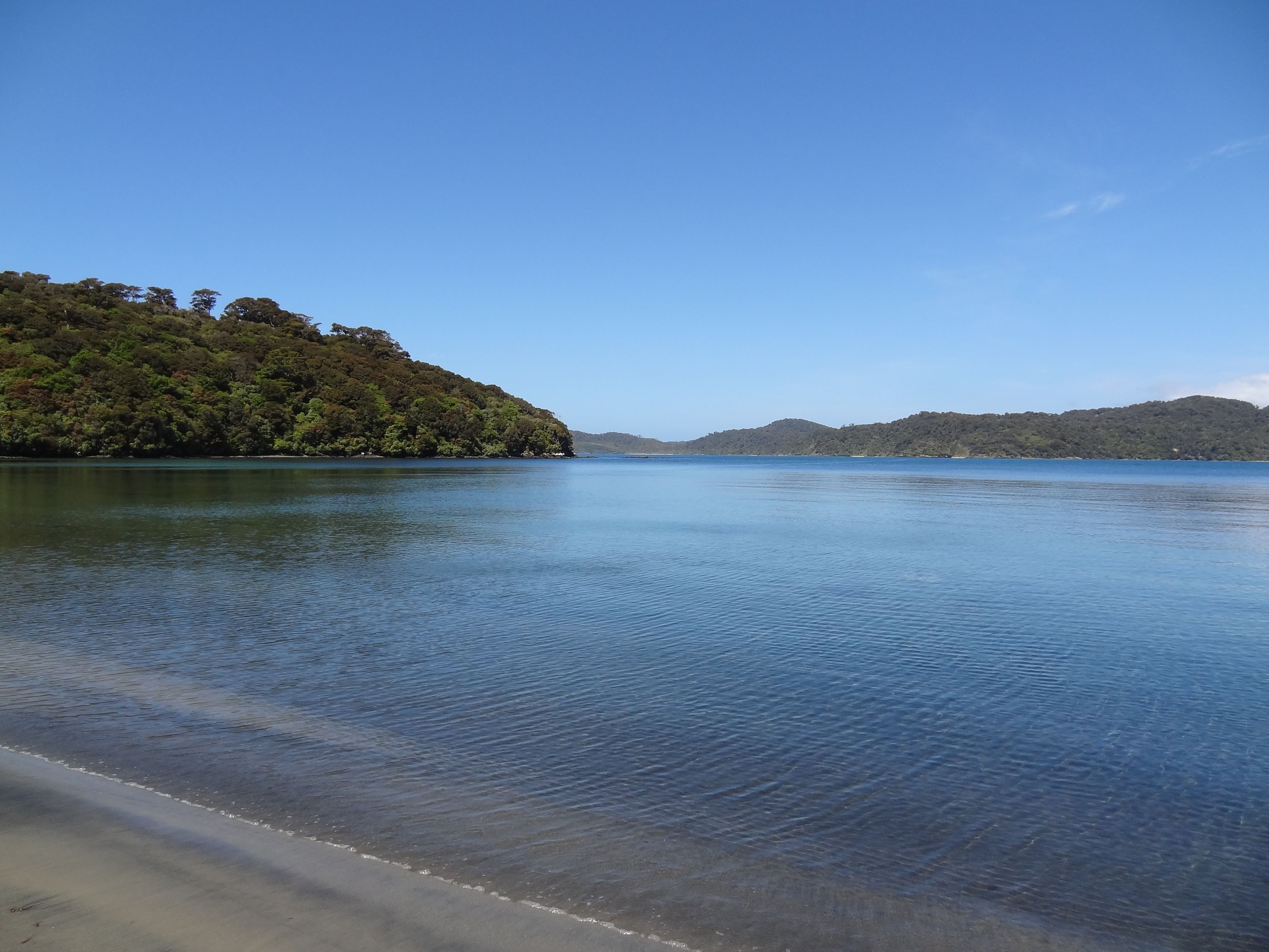
Beach at Port William
Upon arriving at Port William, I met a couple who were only there for lunch, but they’d gone swimming earlier and while the water was cold, it was supposedly nice and refreshing. Of course, hearing that I couldn’t resist and went for a swim myself. And indeed, there you notice exactly how close it is to Antarctica. The water was freezing. Still, fun though and it’s amazing to see water that is so clear that you can see the bottom everywhere.
Later on more people arrived, and we talked a bit. When it became dark though they all went to bed. Personally I figured that I had no idea when I’d have a clear sky again so far removed from any light sources, so I wanted to look at the stars for a bit.
That was really amazing. I don’t have pictures of it, but my first reaction was the quote from 2001 - A Space Odyssey: “Oh my god, it’s full of stars.” Unfortunately, after not too long the sandflies drove me inside as well. Rain was predicted for the next two days that I’d be walking, but it shouldn’t start until the afternoon. As there was a bit of a climb on the second day I decided to leave pretty early so I’d be past that before the rain would start.
I succeeded in this, leaving around 9:30. The track was also a lot faster to walk than the 6 hours that were estimated, in the end taking me about 4.5 hours, which included two 15 minute stops. Once to take pictures (including a Hawaiian shirt one) and once to put on my wet weather gear. It started to be a bit muddy as well around the time it started raining, which made for a far slippier route than I really liked.
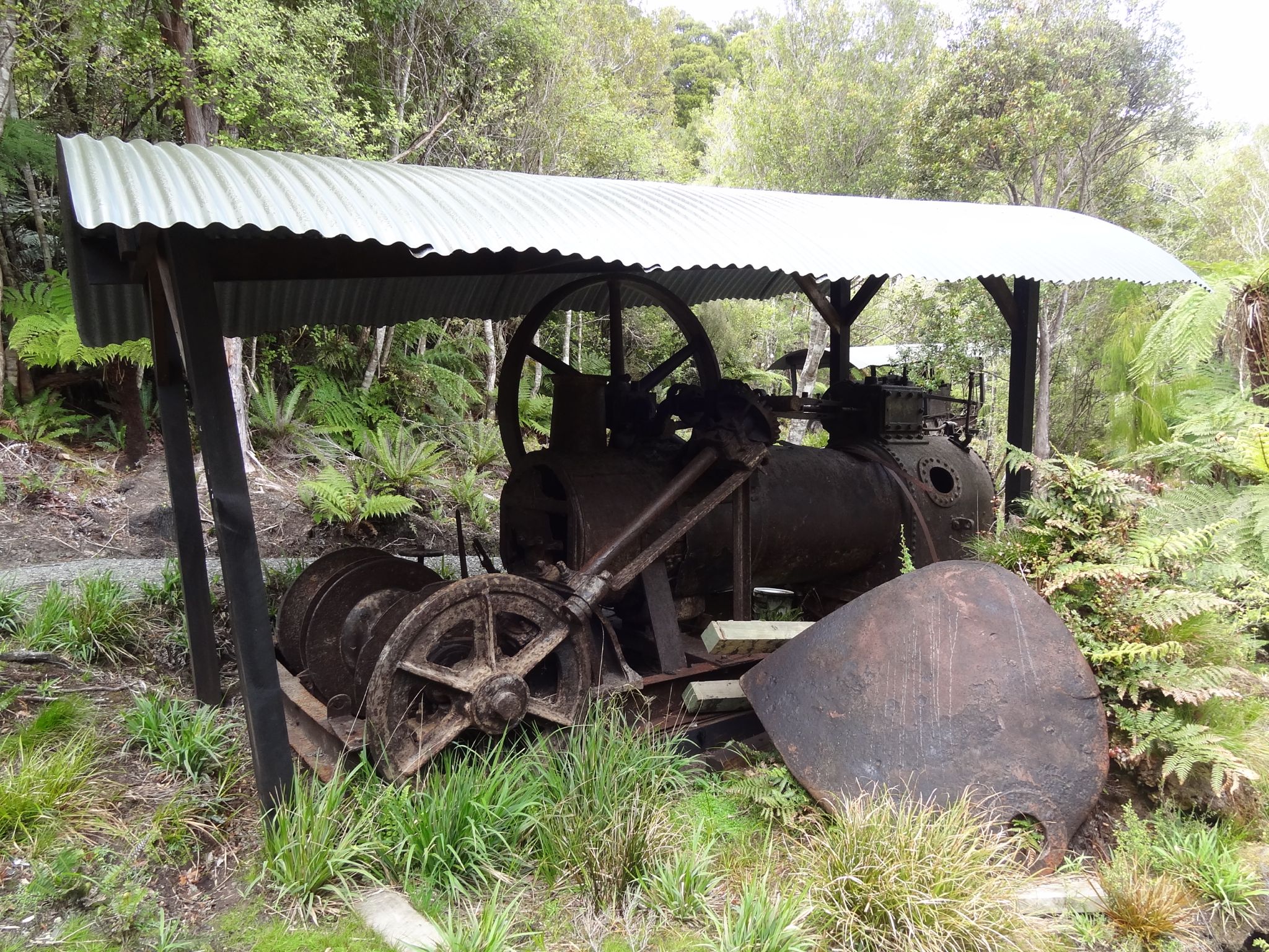
Abandoned Log Hauler
Anyway, that first stop was at the location of two abandoned log haulers. When the milling stopped there, these two were left behind for reasons unknown. It’s rather weird to see two of these big machines in an area where there is only nature everywhere around. But, I still had far to go at that time, so I quickly went on to do the “climbing” that was needed. Basically one big stairway to the top of a small mountain or even large hill.
As said, this went all pretty well and there was a lot of forest to see everywhere around me as I walked. Of course, you couldn’t see far at all, and so I really had no idea where I was except that I’d passed the high climb.
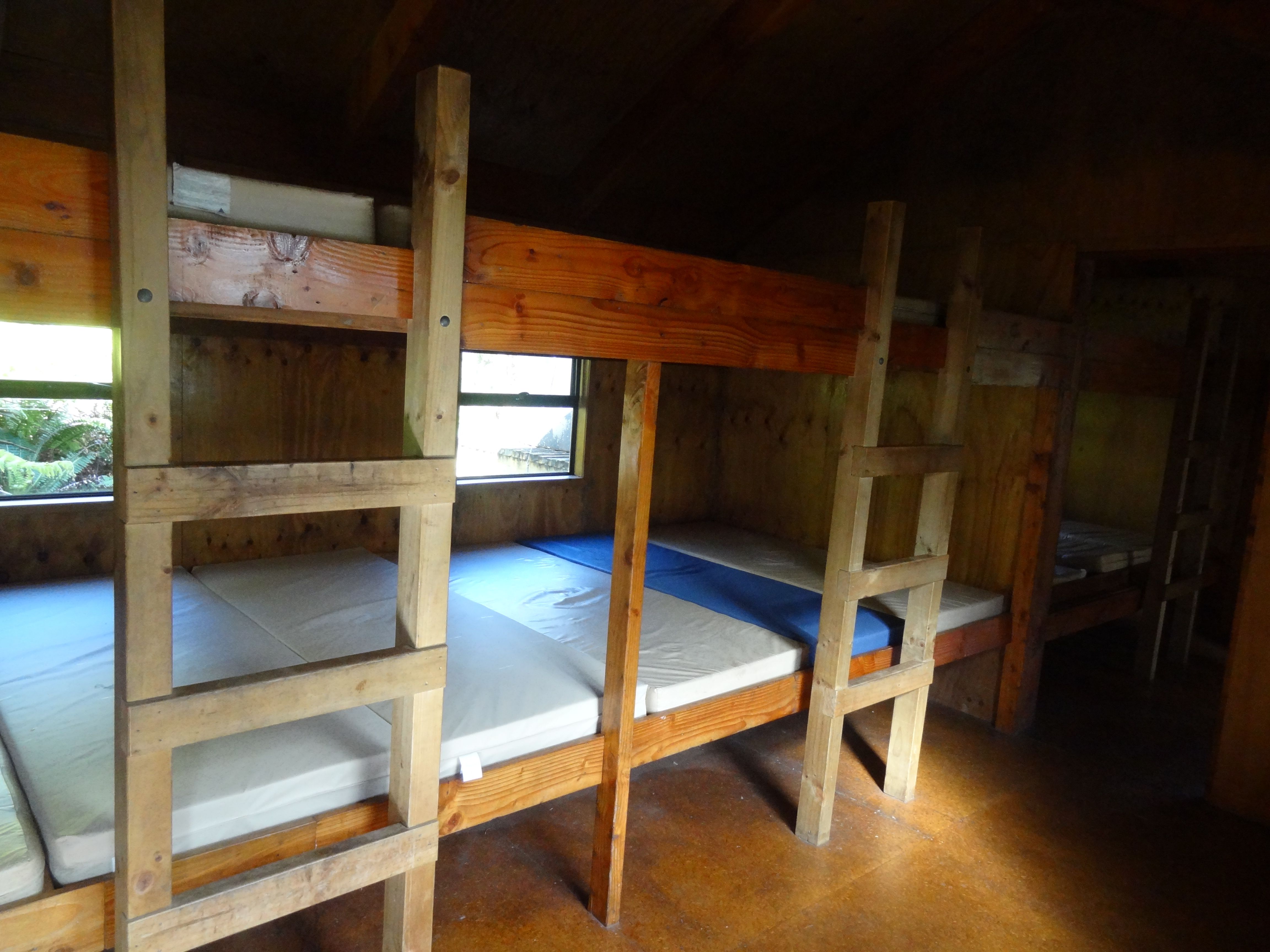
Bunks at North Arm Hut
So, after being rained on for a while (but it being dry again) I finally reached the North Arm Hut, my sleeping place for the night. Just to give people an impression though of the comfort in one of those huts where it comes to sleeping, I’ll refer you to the picture on the left. It’s more cramped than in a hostel, and for those who’ve had the pleasure to sleep on the TU-noob boat it smells like the sleeping compartment there. Still, as it was pretty quiet on the track I didn’t actually have to sleep next to anyone so that was good.
This night, four of the people from last night stayed in this hut as well. These were two Czech exchange students, Alex and Magda, and a Polish couple, Thomas and Kasha. It was pretty fun to talk to them again, and as they were walking slower I could also see how wet I would’ve been if I’d stayed outside for longer. (Yes, it’s fun to see other people enter miserably wet by the time you’re dry again.) There was also a group of kiwi people who were being guided around the track, but walking the other way. They had the fun of telling us about the mud we would be encountering the next day. Well, that was mostly it for that day, as a short search for kiwi’s (the bird type) didn’t turn up anything.
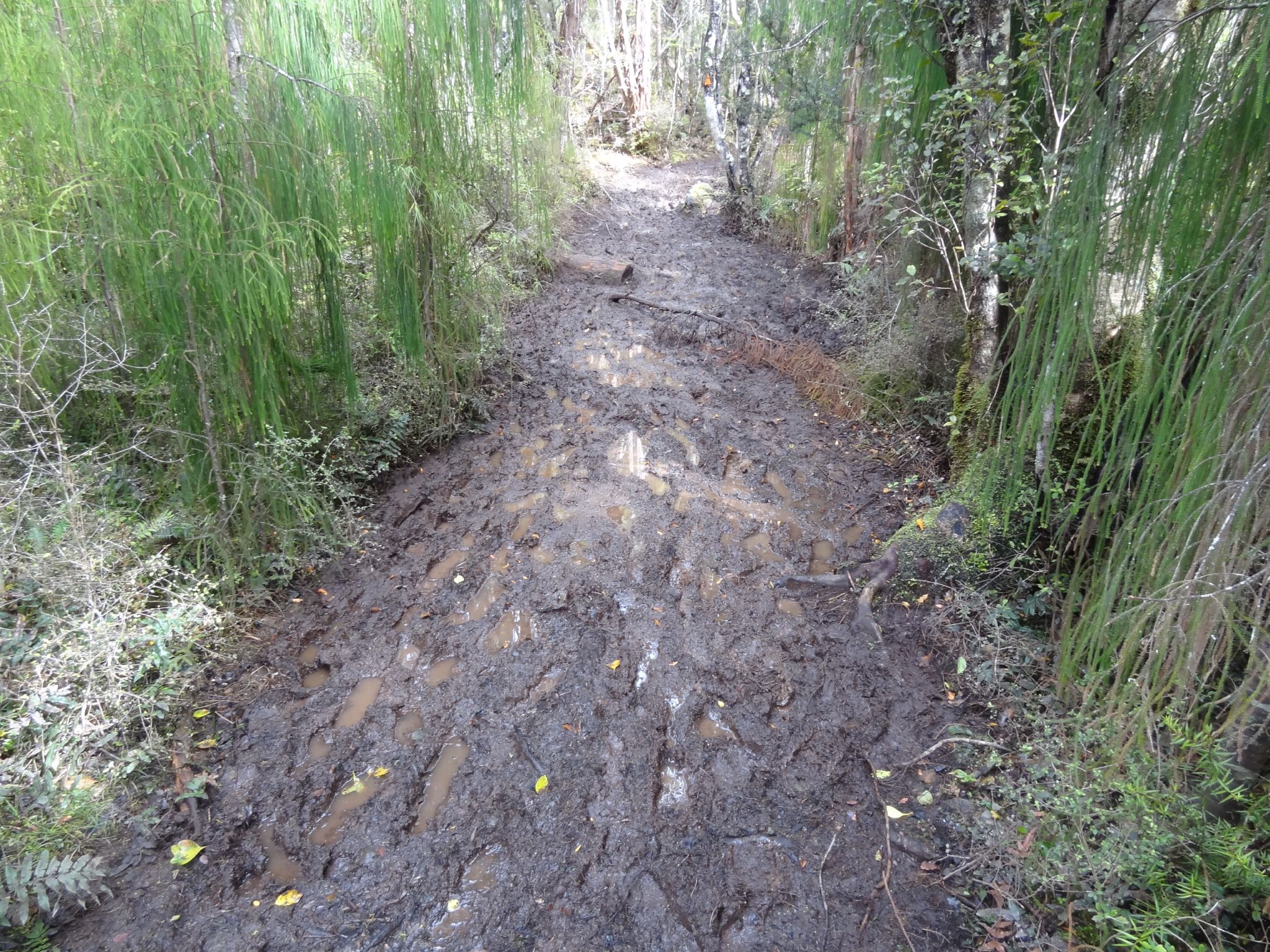
Mud
The next day had two things to say for itself. One, unlike the predictions of even the guide the night before, it was dry and sunny. Two, there was a freakish amount of mud. At the time I really wasn’t a fan of this mud, as trying to get past it would often only make me fall down, which is not a fun experience while carrying a big pack. Nevertheless, looking back on it I can see that it was fun as well. Especially after I gave up on trying to avoid the mud and just splashed through it.
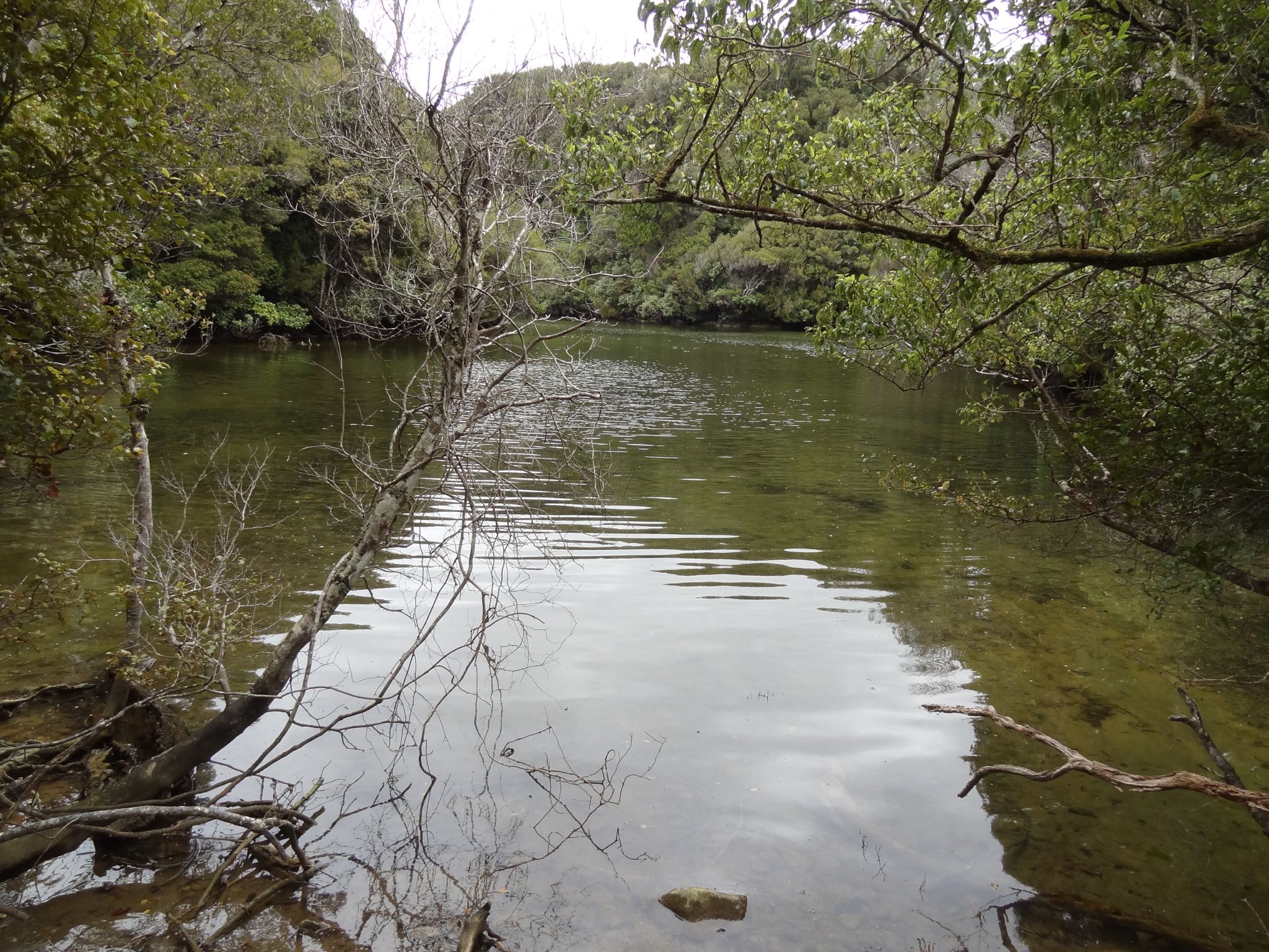
The mud was only for the first 1.5 hours though, after that it became a lot better again and the environment just kept being incredibly beautiful all the time.
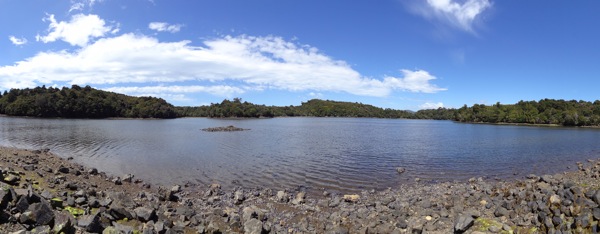
A shot of a bay I can’t remember the name of right now
Ulva Island
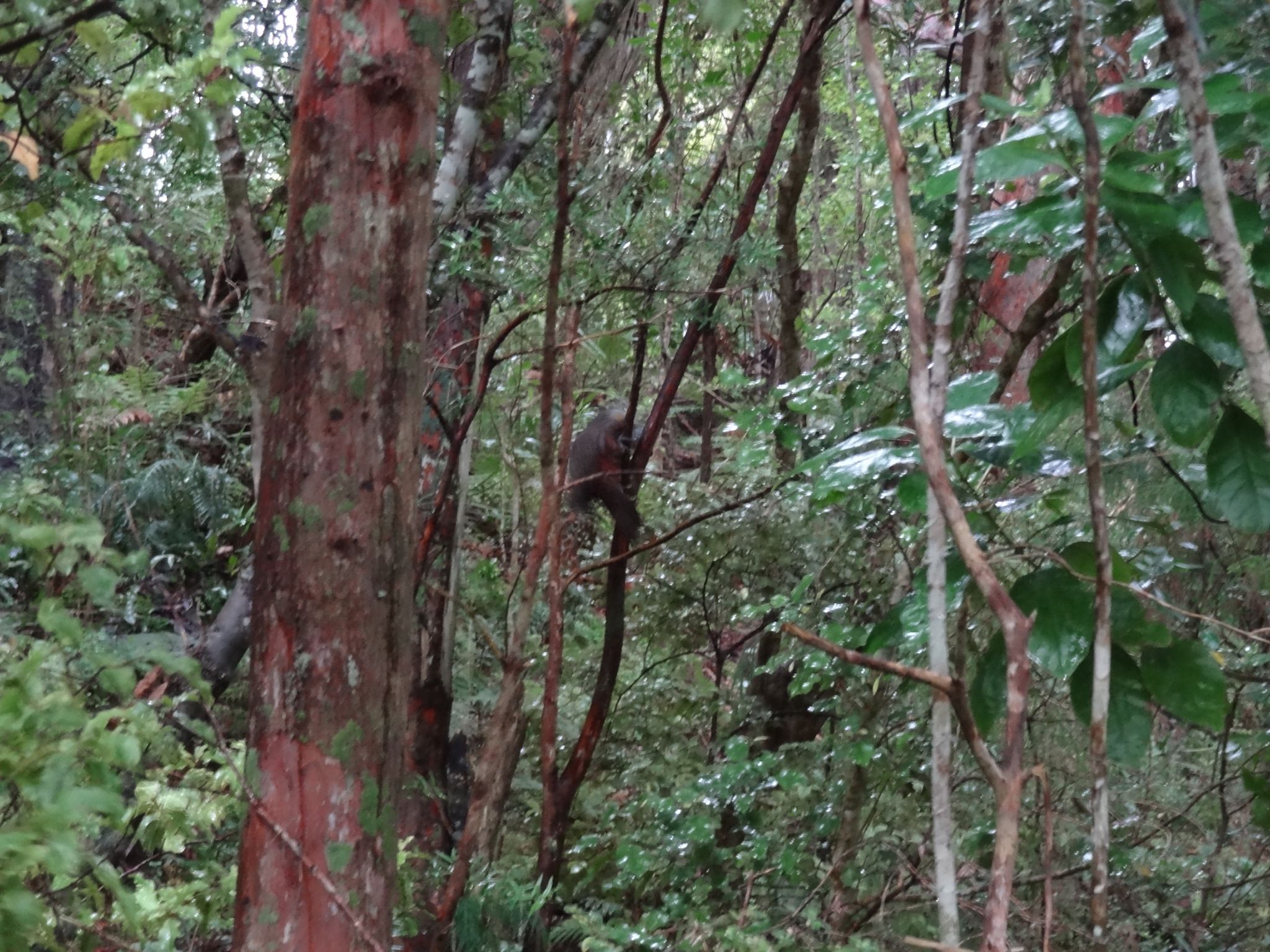
Bird on Ulva Island
After finishing the Raikura trail, I stayed another day so I could visit Ulva Island the next morning. Ulva Island is an island in one of the bays of Stewart Island (so basically, on island of an island of an island), but is made completely free of non-indigenous species. So, only true New Zealand animals live there. This means it’s one of the places where you can get the closest to how New Zealand was before humanity arrived. There’s an amazing number of birds on the island and it’s beautiful to watch these.
As before though, either I’m a really bad photographer without any patience, or it’s incredibly hard to get a good photo of all the birds that are around there. My guess is actually a combination of the two.
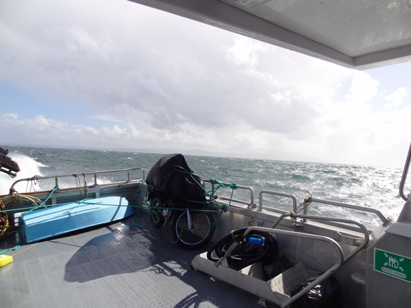
Back to the South Island
The weather had a turn for the worst by the time I was going to leave. The ferry after mine was actually cancelled, and there were some pretty impressive waves. Of course, on a boat there are always some people who enjoy this, (three including me), and a number who can’t handle it. Barf bags were available for them though. The photo below doesn’t do it any justice though, but I’ll see if in the future I can arrange for one of the movies I made of it to be uploaded.